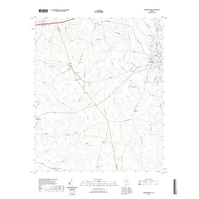
2020 Map of Thomson West
USGS Topo · Published 2020About this map
Thomson and the surrounding McDuffie County countryside are defined by a high density of small family and community burial grounds, revealing a deeply rooted rural genealogy. The landscape transitioning toward the Warren Co line features long-standing settlements like Mesena and Plainview. Numerous small cemeteries such as Hardaway Cem, Joseph McMath Cem, and Stoney Grove Cem are scattered across the terrain, often located near local watercourses like Brier Cr and Mattox Cr.
Find a feature on this map
109 named features on this map. Tap any name to fly to it.
Don’t see what you’re looking for? This feature index may not catch every label — zoom into the map to look around manually.
Map Details
Editions of this 2020 Thomson West Map
This is the sole edition of this map. No revisions or reprints were ever made.
Other maps of this area

1892 · Mc Cormick
USGS Topo · 1:125,000

1906 · Crawfordville
USGS Topo · 1:125,000

1912 · Mc Cormick
USGS Topo · 1:125,000

1921 · Appling
USGS Topo · 1:62,500

1922 · Harlem
USGS Topo · 1:62,500

1943 · Appling
USGS Topo · 1:62,500

1948 · Harlem
USGS Topo · 1:62,500

1948 · Thomson East
USGS Topo · 1:24,000

1950 · Dearing
USGS Topo · 1:24,000
1950 · Bowdens Pond
USGS Topo · 1:24,000