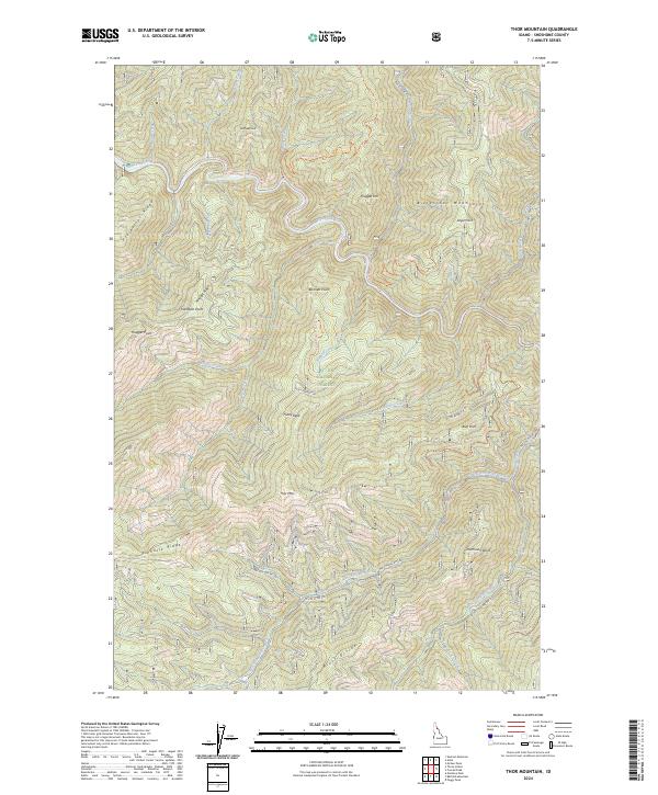
2024 Map of Thor Mountain
USGS Topo · Published 2024About this map
The Saint Joe Wild and Scenic River carves a winding path through the northern reaches of this Shoshone County survey, situated within the expansive St. Joe National Forest. This high-altitude landscape is defined by the massive peaks and spurs of the Bitterroot Mountains, including Thor Mtn and Fuzzy Peak. The complex drainage system is fed by numerous water bodies such as Bottle Creek, Malin Creek, and Eagle Creek, which navigate the steep elevations of Prospector Ridge and Pinnacle Ridge.
Find a feature on this map
44 named features on this map. Tap any name to fly to it.
Don’t see what you’re looking for? This feature index may not catch every label — zoom into the map to look around manually.
Map Details
Editions of this 2024 Thor Mountain Map
This is the sole edition of this map. No revisions or reprints were ever made.
Other maps of this area

1914 · Avery
USGS Topo · 1:125,000

1917 · Avery
USGS Topo · 1:125,000

1918 · St Regis
USGS Topo · 1:125,000

1919 · St. Regis
USGS Topo · 1:125,000

1956 · Saltese
USGS Topo · 1:62,500

1956 · Wallace
USGS Topo · 1:250,000

1957 · Haugan
USGS Topo · 1:62,500

1957 · Simmons Peak
USGS Topo · 1:62,500

1960 · Wallace
USGS Topo · 1:250,000
1969 · Bathtub Mtn
USGS Topo · 1:24,000