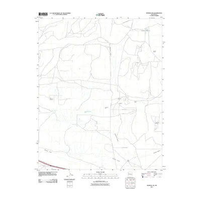
2011 Map of Thoreau NE
USGS Topo · Published 2011About this map
Tom Elkins Mine and several other extraction sites define this high-desert landscape in the early twenty-first century, revealing a region deeply tied to mineral resources. The map documents a scattered network of operations, including the Moe Mine, Mine Number Five, and a significant Uranium Deposit in the northeast. This industrial activity is interspersed with established livestock holdings like Andrews Ranch and Elkins Ranch, highlighting the dual use of the land for ranching and mining. Drainage features such as Casamero Draw and Mitchell Draw provide the primary geographic framework, while the isolated settlement of Francis and the presence of the Escalante Water Well underscore the challenges of water management and residency in this arid New Mexico terrain.
Find a feature on this map
23 named features on this map. Tap any name to fly to it.
Don’t see what you’re looking for? This feature index may not catch every label — zoom into the map to look around manually.
Map Details
Editions of this 2011 Thoreau NE Map
This is the sole edition of this map. No revisions or reprints were ever made.
Other maps of this area

1883 · Mt. Taylor
USGS Topo · 1:250,000

1886 · Wingate
USGS Topo · 1:250,000

1886 · Mt. Taylor
USGS Topo · 1:250,000

1892 · Wingate
USGS Topo · 1:250,000

1892 · Mt. Taylor
USGS Topo · 1:250,000

1899 · Mt. Taylor
USGS Topo · 1:250,000

1954 · Gallup
USGS Topo · 1:250,000

1957 · Bluewater
USGS Topo · 1:24,000

1957 · Goat Mountain
USGS Topo · 1:24,000

1958 · Gallup
USGS Topo · 1:250,000