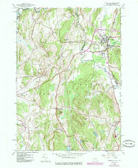
1946 Map of Thorn Hill
USGS Topo · Published 1985About this map
The Poultney River serves as a winding natural boundary between New York and Vermont, anchoring a landscape where agricultural flats meet the rising hills of Washington and Rutland Counties. This mid-century survey, updated with 1970s land use data, highlights the established settlement at Fair Haven, where the Delaware and Hudson RR intersects with local life near St Marys Cem. The map reveals a high density of small rural institutions, from the William Miller Chapel in Low Hampton to numerous numbered schoolhouses like School No 1 and School No 2. Genealogists will find significant value in the scattered burial grounds, including Hampton Flats Cem and Sciota Cem. The transition from the valley floor at Cedar Swamp to prominent heights like Thorn Hill and Bartholomew Hill illustrates the varied terrain that shaped the region's transport routes, notably the Delaware and Hudson Turnpike.
Find a feature on this map
48 named features on this map. Tap any name to fly to it.
Don’t see what you’re looking for? This feature index may not catch every label — zoom into the map to look around manually.
Map Details
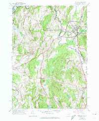
Editions of this 1946 Thorn Hill Map
2 editions found
Other maps of this area

1893 · Fort Ann
USGS Topo · 1:62,500

1893 · Whitehall
USGS Topo · 1:62,500

1894 · Pawlet
USGS Topo · 1:62,500

1895 · Whitehall
USGS Topo · 1:62,500

1895 · Fort Ann
USGS Topo · 1:62,500

1895 · Castleton
USGS Topo · 1:62,500

1897 · Pawlet
USGS Topo · 1:62,500

1897 · Castleton
USGS Topo · 1:62,500

1898 · Whitehall
USGS Topo · 1:62,500

1898 · Fort Ann
USGS Topo · 1:62,500