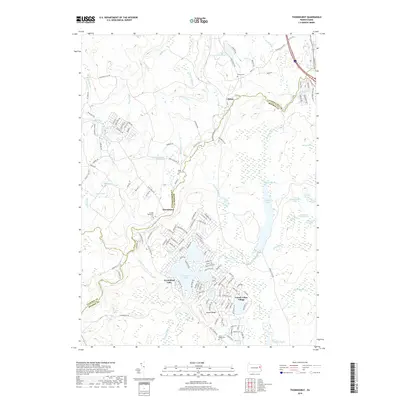
2019 Map of Thornhurst
USGS Topo · Published 2019About this map
The Lehigh River carves a central path through this portion of the Pocono plateau, serving as the boundary between Lackawanna and Monroe counties. This landscape is defined by its transition from traditional crossroads settlements like Clifton and Thornhurst to modern lakeside residential developments. The area around Locust Lakes Village and Arrowhead Lake illustrates the mid-to-late 20th-century growth of recreational communities centered on managed water bodies. Local history is anchored by several burial grounds, including Clifton Cem and the United Methodist Cem near the riverbanks. The eastern half of the map is dominated by the sprawling wetlands and glacial lakes of the state game lands, featuring Bradys Lake and numerous marshy basins like Spring Swamp, showcasing the hydrologic complexity of the region before the creeks descend into the Lehigh valley.
Find a feature on this map
151 named features on this map. Tap any name to fly to it.
Don’t see what you’re looking for? This feature index may not catch every label — zoom into the map to look around manually.
Map Details
Editions of this 2019 Thornhurst Map
This is the sole edition of this map. No revisions or reprints were ever made.
Other maps of this area

1889 · Scranton
USGS Topo · 1:62,500

1891 · Scranton
USGS Topo · 1:62,500

1893 · Scranton
USGS Topo · 1:62,500

1919 · Pocono
USGS Topo · 1:62,500

1921 · Pocono
USGS Topo · 1:62,500

1922 · Stoddartsville
USGS Topo · 1:62,500

1923 · Pocono
USGS Topo · 1:62,500

1924 · Stoddartsville
USGS Topo · 1:62,500

1928 · Ariel
USGS Topo · 1:62,500

1932 · Ariel
USGS Topo · 1:62,500
Featured Places
- Clifton Township, PA
- Thornhurst Township, PA
- Buck Township, PA
- Coolbaugh Township, PA
- Tobyhanna Township, PA