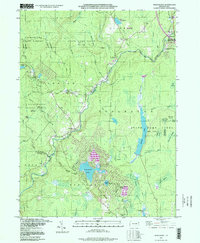
1997 Map of Thornhurst
USGS Topo · Published 1998About this map
The Lehigh River carves a deep valley through this corner of the Poconos, acting as a natural boundary between Lackawanna, Monroe, and Luzerne counties. In the late 1990s, the landscape is defined by vast protected tracts, including Lackawanna State Forest and multiple state game lands. The transition from industrial-era extraction to recreation is evident in the presence of old infrastructure like Fenner Mill Run and a Quarry near Sand Spring Creek, contrasted with established residential and resort developments such as Locust Lakes Village and the settlements of Clifton and Thornhurst.
Find a feature on this map
68 named features on this map. Tap any name to fly to it.
Don’t see what you’re looking for? This feature index may not catch every label — zoom into the map to look around manually.
Map Details
Editions of this 1997 Thornhurst Map
This is the sole edition of this map. No revisions or reprints were ever made.
Other maps of this area

1889 · Scranton
USGS Topo · 1:62,500

1891 · Scranton
USGS Topo · 1:62,500

1893 · Scranton
USGS Topo · 1:62,500

1919 · Pocono
USGS Topo · 1:62,500

1921 · Pocono
USGS Topo · 1:62,500

1922 · Stoddartsville
USGS Topo · 1:62,500

1923 · Pocono
USGS Topo · 1:62,500

1924 · Stoddartsville
USGS Topo · 1:62,500

1928 · Ariel
USGS Topo · 1:62,500

1932 · Ariel
USGS Topo · 1:62,500
Featured Places
- Clifton Township, PA
- Thornhurst Township, PA
- Buck Township, PA
- Tobyhanna Township, PA
- Lehigh Township, PA