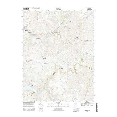
2014 Map of Thornton
USGS Topo · Published 2014About this map
Grafton and its outlying communities define the landscape of Taylor County in this survey, where the deep valleys of Three Fork Creek and Sandy Creek meet the northern reaches of Tygart Lake. The settlement pattern reflects the traditional Appalachian terrain, with small clusters like Thornton, Knottsville, and Hiram established along the winding creeks and hollows. Family history is well-preserved through numerous burial grounds, including the Wesley Chapel Cem, Knottsville Cem, and Mt Pleasant Cem. Infrastructure such as the Thornton Bridge and the Larew Airport highlight the area's twentieth-century modernization. The map also delineates the precise boundaries where Taylor, Barbour, and Preston counties converge near the village of Dent, providing a clear view of the regional borders and the complex network of state routes like WV-92 and Us-50, known here as the George Washington Hwy.
Find a feature on this map
48 named features on this map. Tap any name to fly to it.
Don’t see what you’re looking for? This feature index may not catch every label — zoom into the map to look around manually.
Map Details
Editions of this 2014 Thornton Map
This is the sole edition of this map. No revisions or reprints were ever made.
Other maps of this area

1886 · St. George
USGS Topo · 1:125,000

1891 · St. George
USGS Topo · 1:125,000

1902 · Fairmont
USGS Topo · 1:62,500

1904 · Philippi
USGS Topo · 1:62,500

1907 · Thornton
USGS Topo · 1:62,500

1907 · Belington
USGS Topo · 1:62,500

1923 · Fairmont
USGS Topo · 1:62,500

1925 · Philippi
USGS Topo · 1:62,500

1926 · Fairmont
USGS Topo · 1:62,500

1926 · Thornton
USGS Topo · 1:62,500