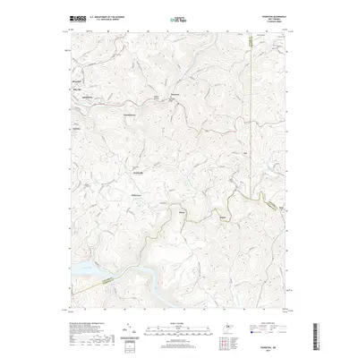
2019 Map of Thornton
USGS Topo · Published 2019About this map
Grafton serves as a primary hub on this Taylor County landscape, where the confluence of steep terrain and water has long shaped local development. The map details the rugged topography defined by Wilson Ridge and the winding course of Three Fork Creek, which passes under the Thornton Bridge. To the south, the waters of Tygart Lake dominate the valley floor at the border of Barbour County. This 2019 survey documents a network of small rural communities like Knottsville and Thornton, alongside several historic burial grounds including Knottsville Cem and Mount Pleasant Cem. The inclusion of the American Discovery Trail highlights the area's modern recreational usage through the same hills where long-established settlements such as Millertown and Claude remain connected by winding mountain roads.
Find a feature on this map
48 named features on this map. Tap any name to fly to it.
Don’t see what you’re looking for? This feature index may not catch every label — zoom into the map to look around manually.
Map Details
Editions of this 2019 Thornton Map
This is the sole edition of this map. No revisions or reprints were ever made.
Other maps of this area

1886 · St. George
USGS Topo · 1:125,000

1891 · St. George
USGS Topo · 1:125,000

1902 · Fairmont
USGS Topo · 1:62,500

1904 · Philippi
USGS Topo · 1:62,500

1907 · Thornton
USGS Topo · 1:62,500

1907 · Belington
USGS Topo · 1:62,500

1923 · Fairmont
USGS Topo · 1:62,500

1925 · Philippi
USGS Topo · 1:62,500

1926 · Fairmont
USGS Topo · 1:62,500

1926 · Thornton
USGS Topo · 1:62,500