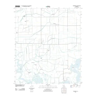
2012 Map of Thornwell
USGS Topo · Published 2012About this map
The Great Quelqueshoe Prairie defines the northern reaches of this coastal Louisiana landscape, giving way to an intricate system of drainage and energy infrastructure. The small settlements of Thornwell and Lowry are surrounded by an extensive network of canals, including the Niblett Canal and the Thornwell Drainage Canal, which manage the low-lying terrain near the Mermentau River. This era of the early 21st century shows a landscape heavily shaped by the petroleum industry, evidenced by the South Thornwell Gas Field and the Southwest Lake Arthur Gas Field. Transportation and aviation are anchored by local airstrips such as Lyon Airport and Goose Island Airport, which serve this agricultural and industrial region. Along the southern margins, the map reveals a mosaic of marshy landmarks with distinctive names like Wildcat Ridge, Goose Island, and Biscuit Island situated near the waters of Lake Arthur.
Find a feature on this map
47 named features on this map. Tap any name to fly to it.
Don’t see what you’re looking for? This feature index may not catch every label — zoom into the map to look around manually.
Map Details
Editions of this 2012 Thornwell Map
This is the sole edition of this map. No revisions or reprints were ever made.
Other maps of this area

1934 · Lake Misere
USGS Topo · 1:24,000

1934 · Latania Lake
USGS Topo · 1:24,000

1935 · Lake Misere
USGS Topo · 1:31,680

1935 · Latania Lake
USGS Topo · 1:31,680

1946 · Lacassine
USGS Topo · 1:31,680

1946 · Lake Arthur
USGS Topo · 1:31,680

1946 · Hayes
USGS Topo · 1:31,680

1946 · Jennings
USGS Topo · 1:31,680

1947 · Thornwell
USGS Topo · 1:31,680

1947 · Welsh
USGS Topo · 1:31,680