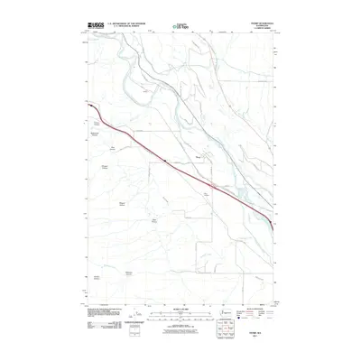
2011 Map of Thorp
USGS Topo · Published 2011About this map
The Yakima River snakes through the Kittitas Valley on this 2011 survey, defining the agricultural and logistical heart of the Thorp area. The town of Thorp and the nearby settlement of Dudley are linked by the N Thorp Hwy and the historic rail corridor now designated as the Iron Horse Trl. The map illustrates a complex network of water management essential to this arid region, including the Ellensburg Power Canal, West Side Canal, and Taneum Ditch.
Find a feature on this map
45 named features on this map. Tap any name to fly to it.
Don’t see what you’re looking for? This feature index may not catch every label — zoom into the map to look around manually.
Map Details
Editions of this 2011 Thorp Map
This is the sole edition of this map. No revisions or reprints were ever made.
Other maps of this area

1897 · Mount Stuart
USGS Topo · 1:125,000

1899 · Ellensburg
USGS Topo · 1:125,000

1901 · Ellensburg
USGS Topo · 1:125,000

1902 · Mount Stuart
USGS Topo · 1:125,000

1950 · Yakima
USGS Topo · 1:250,000

1957 · Wenatchee
USGS Topo · 1:250,000
1958 · Ellensburg South
USGS Topo · 1:24,000

1958 · Thorp
USGS Topo · 1:24,000

1958 · Ellensburg
USGS Topo · 1:62,500

1958 · Thorp
USGS Topo · 1:62,500