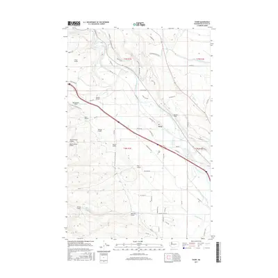
2017 Map of Thorp
USGS Topo · Published 2017About this map
Thorp sits at the nexus of a complex water management network where the Yakima River enters the broad Kittitas Valley. This 2017 study illustrates a landscape profoundly shaped by irrigation engineering, dominated by the paths of the Taneum Ditch, North Branch Canal, W Side Canal, and the Ellensburg Power Canal. These artificial waterways cut across the natural drainage of numerous deep-cut landforms including Taneum Canyon, Watt Canyon, and Robinson Canyon, which descend from the western uplands toward the river valley. The settlement pattern is largely defined by the Thorp Hwy and the railroad corridor, with the Thorp Cemetery situated on a rise east of the town center. To the northwest, the open expanse of Thorp Prairie provides a contrast to the concentrated agricultural and residential activity found along the riverbanks and the various reclamation district roads.
Find a feature on this map
70 named features on this map. Tap any name to fly to it.
Don’t see what you’re looking for? This feature index may not catch every label — zoom into the map to look around manually.
Map Details
Editions of this 2017 Thorp Map
This is the sole edition of this map. No revisions or reprints were ever made.
Other maps of this area

1897 · Mount Stuart
USGS Topo · 1:125,000

1899 · Ellensburg
USGS Topo · 1:125,000

1901 · Ellensburg
USGS Topo · 1:125,000

1902 · Mount Stuart
USGS Topo · 1:125,000

1950 · Yakima
USGS Topo · 1:250,000

1957 · Wenatchee
USGS Topo · 1:250,000
1958 · Ellensburg South
USGS Topo · 1:24,000

1958 · Thorp
USGS Topo · 1:24,000

1958 · Ellensburg
USGS Topo · 1:62,500

1958 · Thorp
USGS Topo · 1:62,500