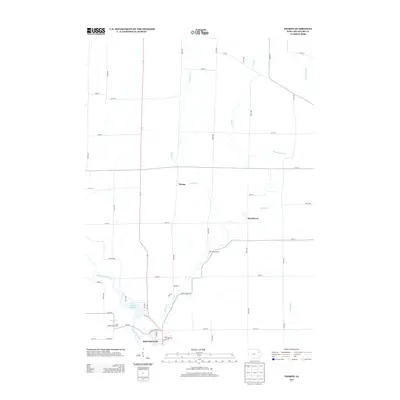
2013 Map of Thorpe
USGS Topo · Published 2013About this map
The Maquoketa River and its varied tributaries, including Lindsey Cr and Honey Cr, define the drainage and agricultural layout of this Delaware County landscape. In the southern portion of the map, the northern limits of Manchester are visible, featuring the Quaker Mill Pond and Hart Ridge Golf Course along the river's bend. The area is characterized by a precise grid of rural roads, such as Honey Creek Rd and Firefly Rd, that connect small settlements like Thorpe and Dutchtown. A notable point of local history is the Red Schoolhouse, situated centrally among the farm sections. The map also traces several branches, including Routherford Br and Spring Br, which carve through the Iowa prairie, illustrating the relationship between the natural waterways and the established township road system.
Find a feature on this map
46 named features on this map. Tap any name to fly to it.
Don’t see what you’re looking for? This feature index may not catch every label — zoom into the map to look around manually.
Map Details
Editions of this 2013 Thorpe Map
This is the sole edition of this map. No revisions or reprints were ever made.
Other maps of this area

1900 · Anamosa
USGS Topo · 1:125,000

1901 · Oelwein
USGS Topo · 1:125,000

1902 · Elkader
USGS Topo · 1:125,000

1903 · Winthrop
USGS Topo · 1:125,000

1959 · Dubuque
USGS Topo · 1:250,000

1961 · Dubuque
USGS Topo · 1:250,000

1962 · Dubuque
USGS Topo · 1:250,000

1964 · Edgewood
USGS Topo · 1:24,000

1964 · Garber
USGS Topo · 1:24,000

1965 · Thorpe
USGS Topo · 1:24,000