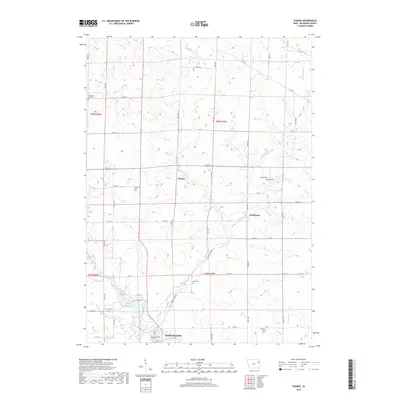
2018 Map of Thorpe
USGS Topo · Published 2018About this map
Manchester anchors the southern edge of this Delaware County landscape, where the Maquoketa River meets the industrial history of the Quaker Mill Pond. This area is defined by its transition from the structured street grid of the county seat to the expansive agricultural tracts of the north. Small rural centers like Thorpe and Dutchtown serve as local landmarks within a dense network of county roads. The landscape is deeply etched by waterways including Lindsey Cr, Honey Creek, and Routherford Br. For those tracing local families, the map is a significant record of rural burial grounds, including the Thorpe Union Cem, Hutson Cem, and Mead Cem. The distribution of these cemeteries and the winding course of Spring Br reflect the long-standing settlement patterns of the Iowa prairie.
Find a feature on this map
50 named features on this map. Tap any name to fly to it.
Don’t see what you’re looking for? This feature index may not catch every label — zoom into the map to look around manually.
Map Details
Editions of this 2018 Thorpe Map
This is the sole edition of this map. No revisions or reprints were ever made.
Other maps of this area

1900 · Anamosa
USGS Topo · 1:125,000

1901 · Oelwein
USGS Topo · 1:125,000

1902 · Elkader
USGS Topo · 1:125,000

1903 · Winthrop
USGS Topo · 1:125,000

1959 · Dubuque
USGS Topo · 1:250,000

1961 · Dubuque
USGS Topo · 1:250,000

1962 · Dubuque
USGS Topo · 1:250,000

1964 · Edgewood
USGS Topo · 1:24,000

1964 · Garber
USGS Topo · 1:24,000

1965 · Thorpe
USGS Topo · 1:24,000