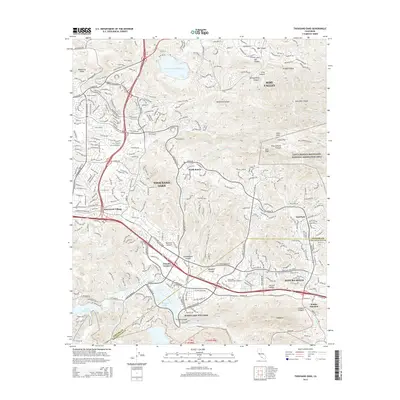
2015 Map of Thousand Oaks
USGS Topo · Published 2015About this map
Thousand Oaks and Westlake Village dominate the interior of this 2015 survey, where the suburban landscape meets the northern boundary of the Santa Monica Mountains National Recreation Area. The map reveals a complex interface of developed residential neighborhoods and preserved natural terrain, particularly around the Simi Hills and Simi Peak. Established landmarks such as the Olson Cemetery and Valley Oaks Memorial Park Cemetery provide points of interest for local researchers, while the area's hydrology is marked by Westlake Lake, Lake Sherwood, and the Wood Ranch Reservoir. The transition between Ventura and Los Angeles counties is clearly delineated as it passes through Agoura Hills and Malibu Junction, illustrating the continuous growth across this Southern California corridor.
Find a feature on this map
48 named features on this map. Tap any name to fly to it.
Don’t see what you’re looking for? This feature index may not catch every label — zoom into the map to look around manually.
Map Details
Editions of this 2015 Thousand Oaks Map
This is the sole edition of this map. No revisions or reprints were ever made.
Other maps of this area

1900 · Triunfo Pass
USGS Topo · 1:62,500

1900 · Piru
USGS Topo · 1:62,500

1903 · Calabasas
USGS Topo · 1:62,500

1903 · Camulos
USGS Topo · 1:125,000

1903 · Santa Susana
USGS Topo · 1:62,500

1921 · Piru
USGS Topo · 1:62,500

1921 · Triunfo Pass
USGS Topo · 1:62,500

1929 · Vejor
USGS Topo · 1:24,000

1932 · Seminole
USGS Topo · 1:24,000

1932 · Russell Valley
USGS Topo · 1:24,000
Featured Places
- Thousand Oaks, CA
- Simi Valley, CA
- Agoura Hills, CA
- Westlake Village, CA
- Unincorporated Santa Monica Mountains, CA