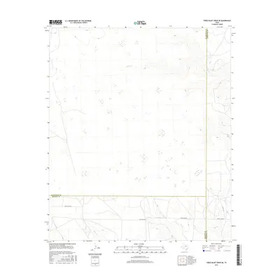
2016 Map of Three Bluff Draw NE
USGS Topo · Published 2016About this map
The High Plains of West Texas are defined by sparse drainages and the intersection of three counties in this 2016 survey. Sterling Cr flows through the northern reaches, while Indian Cr and Concho Cr trace the southern terrain near the Glasscock, Reagan, and Sterling county lines. This landscape remains largely defined by its rural infrastructure, with Radio Tower Rd and Old Big Lake Rd providing the primary transit through the arid landscape. The map provides a precise view of the region's hydrography and elevation before more recent developments, showing how the natural draws dictate the placement of ranch roads like Co Rd 129-P.
Find a feature on this map
9 named features on this map. Tap any name to fly to it.
Don’t see what you’re looking for? This feature index may not catch every label — zoom into the map to look around manually.
Map Details
Editions of this 2016 Three Bluff Draw NE Map
This is the sole edition of this map. No revisions or reprints were ever made.
Other maps of this area

1954 · San Angelo
USGS Topo · 1:250,000

1958 · San Angelo
USGS Topo · 1:250,000

1963 · Glass Ranch
USGS Topo · 1:24,000

1963 · Currie Reservoir
USGS Topo · 1:24,000

1963 · Garden City
USGS Topo · 1:24,000

1965 · San Angelo
USGS Topo · 1:250,000

1973 · Hay Hollow
USGS Topo · 1:24,000

1973 · Three Bluff Draw
USGS Topo · 1:24,000

1973 · Three Bluff Draw NE
USGS Topo · 1:24,000
1973 · Coon Dive Draw NW
USGS Topo · 1:24,000