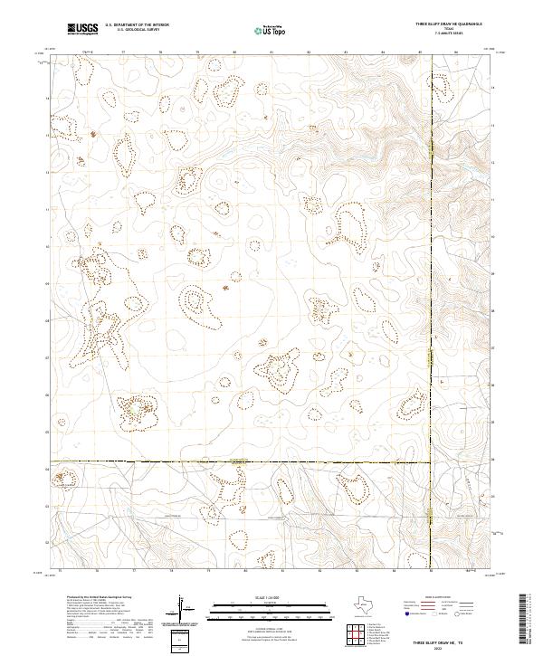
2022 Map of Three Bluff Draw NE
USGS Topo · Published 2022About this map
Sterling Cr flows through the upper reaches of this West Texas landscape, where the borders of Glasscock, Sterling, and Reagan counties converge. The terrain is defined by a series of intermittent drainage systems and draws, typical of the arid plateau region. In the southern portion of the sheet, the road network transitions from rural tracks to more defined routes like Radio Tower Rd and Old Big Lake Rd, reflecting the sparse but essential infrastructure needed to navigate this section of the Permian Basin. This survey captures the topographical character of the land just as it has transitioned into modern multi-use territory, dominated by ranching and industrial access. Local researchers can trace the course of Indian Cr and Corral Cr as they cut through the elevation contours, illustrating how water has historically shaped movement across these high plains.
Find a feature on this map
9 named features on this map. Tap any name to fly to it.
Don’t see what you’re looking for? This feature index may not catch every label — zoom into the map to look around manually.
Map Details
Editions of this 2022 Three Bluff Draw NE Map
This is the sole edition of this map. No revisions or reprints were ever made.
Other maps of this area

1954 · San Angelo
USGS Topo · 1:250,000

1958 · San Angelo
USGS Topo · 1:250,000

1963 · Glass Ranch
USGS Topo · 1:24,000

1963 · Currie Reservoir
USGS Topo · 1:24,000

1963 · Garden City
USGS Topo · 1:24,000

1965 · San Angelo
USGS Topo · 1:250,000

1973 · Hay Hollow
USGS Topo · 1:24,000

1973 · Three Bluff Draw
USGS Topo · 1:24,000

1973 · Three Bluff Draw NE
USGS Topo · 1:24,000
1973 · Coon Dive Draw NW
USGS Topo · 1:24,000