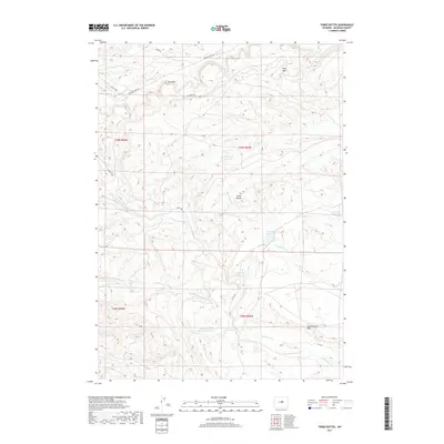
2017 Map of Three Buttes
USGS Topo · Published 2017About this map
The Three Buttes rise above a landscape defined by significant geologic exposures in central Wyoming, most notably the towering Red Wall and Gray Wall escarpments. This 2017 survey details the complex network of ephemeral drainages and cattle water developments that support ranching in the high desert of Natrona County. Notable water features include Three Buttes Reservoir, Little Chief Reservoir, and the Big Jerry Reservoir, which capture runoff from seasonal streams like Three Buttes Cr and Cottonwood Cr. The topography is marked by distinct landforms such as Black Mesa and Cottonwood Rim, while the human footprint is primarily limited to rural routes like Buffalo Creek Rd and Co Rd 108, illustrating the area's continued use for open-range grazing.
Find a feature on this map
25 named features on this map. Tap any name to fly to it.
Don’t see what you’re looking for? This feature index may not catch every label — zoom into the map to look around manually.
Map Details
Editions of this 2017 Three Buttes Map
This is the sole edition of this map. No revisions or reprints were ever made.
Other maps of this area

1952 · Deadman Butte
USGS Topo · 1:24,000

1952 · Grave Spring
USGS Topo · 1:24,000

1952 · Waltman NW
USGS Topo · 1:24,000

1955 · Arminto
USGS Topo · 1:250,000

1958 · Arminto
USGS Topo · 1:250,000

1962 · Arminto
USGS Topo · 1:250,000

1968 · First Water Draw
USGS Topo · 1:24,000
1968 · Notches Dome
USGS Topo · 1:24,000

1968 · Roughlock Hill
USGS Topo · 1:24,000

1968 · Flat Top Hill
USGS Topo · 1:24,000