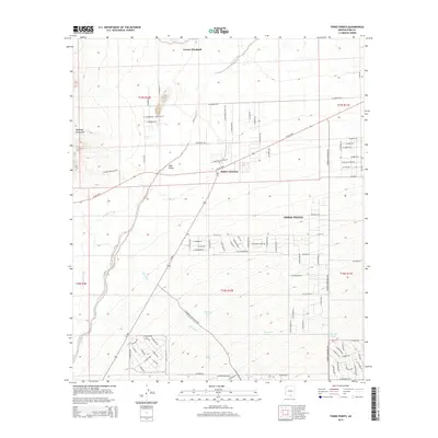
2014 Map of Three Points
USGS Topo · Published 2014About this map
Robles Junction and the community of Three Points sit at the intersection of major desert thoroughfares within the Altar Valley. This Pima County landscape is defined by the convergence of ephemeral drainages, including Brawley Wash, Mendoza Wash, and Soto Wash, which flow past the eastern foothills of the Roskruge Mountains. The map reveals a transition from traditional desert ranching features, such as the Corner Windmill and various water catchments like San-Juan Tank and Javelina Tank, to modern residential development seen in the expanding grid of streets south of W Ajo Hwy. Notable local landmarks include the Tucson Rifle Club Rd and the extensive network of rural routes such as W Diamond Bell Ranch Rd, reflecting the area's continued growth as a desert outpost west of Tucson.
Find a feature on this map
97 named features on this map. Tap any name to fly to it.
Don’t see what you’re looking for? This feature index may not catch every label — zoom into the map to look around manually.
Map Details
Editions of this 2014 Three Points Map
This is the sole edition of this map. No revisions or reprints were ever made.
Other maps of this area

1920 · Arivaca
USGS Topo · 1:125,000

1925 · Samaniego Peak
USGS Topo · 1:62,500

1925 · San Xavier
USGS Topo · 1:62,500

1934 · Tucson Mountains
USGS Topo · 1:125,000

1939 · Twin Buttes
USGS Topo · 1:62,500

1940 · Palo Alto Ranch
USGS Topo · 1:62,500

1941 · Twin Buttes
USGS Topo · 1:62,500

1941 · Cocoraque Butte
USGS Topo · 1:62,500

1943 · Cocoraque Butte
USGS Topo · 1:62,500

1943 · Palo Alto Ranch
USGS Topo · 1:62,500