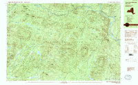
1990 Map of Three Ponds Mountain
USGS Topo · Published 1990About this map
Adirondack Park dominates this topography, where the Sacandaga River and its branches carve through the highlands of Hamilton County. The map reveals a landscape defined by isolated peaks and high-elevation water bodies, such as Three Ponds and the expansive Silver Lake. Small pockets of human activity are clustered along the waterways and road corridors, notably at Upper Benson and the logging-era remnants at Whitehouse.
Find a feature on this map
74 named features on this map. Tap any name to fly to it.
Don’t see what you’re looking for? This feature index may not catch every label — zoom into the map to look around manually.
Map Details
Editions of this 1990 Three Ponds Mountain Map
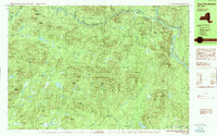
2 editions found
Other maps of this area

1899 · Broadalbin
USGS Topo · 1:62,500

1901 · Lassellsville
USGS Topo · 1:62,500

1902 · Broadalbin
USGS Topo · 1:62,500

1903 · Gloversville
USGS Topo · 1:62,500

1903 · Lassellsville
USGS Topo · 1:62,500

1904 · Piseco Lake
USGS Topo · 1:62,500

1906 · Piseco Lake
USGS Topo · 1:62,500

1907 · Lake Pleasant
USGS Topo · 1:62,500

1908 · Piseco Lake
USGS Topo · 1:62,500

1910 · Stony Creek
USGS Topo · 1:62,500