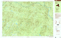
1997 Map of Three Ponds Mountain
USGS Topo · Published 1999About this map
Adirondack Park dominates this terrain in Hamilton County, where the West Branch Sacandaga River carves a deep valley through a landscape defined by high peaks and scattered water bodies. The settlement pattern is sparse, limited to peripheral outposts like Whitehouse, Blackbridge, and Benson. This late-twentieth-century study documents the preservation of wilderness character, showing interior access primarily through the Ninemile Trail and remote landmarks such as the Hell Devil Dam (Site).
Find a feature on this map
82 named features on this map. Tap any name to fly to it.
Don’t see what you’re looking for? This feature index may not catch every label — zoom into the map to look around manually.
Map Details
Editions of this 1997 Three Ponds Mountain Map
This is the sole edition of this map. No revisions or reprints were ever made.
Other maps of this area

1899 · Broadalbin
USGS Topo · 1:62,500

1901 · Lassellsville
USGS Topo · 1:62,500

1902 · Broadalbin
USGS Topo · 1:62,500

1903 · Gloversville
USGS Topo · 1:62,500

1903 · Lassellsville
USGS Topo · 1:62,500

1904 · Piseco Lake
USGS Topo · 1:62,500

1906 · Piseco Lake
USGS Topo · 1:62,500

1907 · Lake Pleasant
USGS Topo · 1:62,500

1908 · Piseco Lake
USGS Topo · 1:62,500

1910 · Stony Creek
USGS Topo · 1:62,500