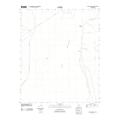
2010 Map of Three Rivers NW
USGS Topo · Published 2010About this map
White Sands Missile Range dominates the western half of this landscape, defining a high-desert environment where military infrastructure meets traditional New Mexico ranching. The presence of isolated ranching outposts like Roberson Place, Lathan Ranch, and Mayes Ranch provides specific coordinates for family history research in this arid region of Lincoln County. The terrain is marked by the dramatic geological signature of The Malpais, an extensive lava field that contrasts sharply with the nearby Phillips Hills. Access through this restricted environment is provided by specialized corridors such as WSMR P Route 9 and WSMR S Route 312, reflecting the area's dual role as both a rangeland and a sensitive defense installation during the early 21st century.
Find a feature on this map
8 named features on this map. Tap any name to fly to it.
Don’t see what you’re looking for? This feature index may not catch every label — zoom into the map to look around manually.
Map Details
Editions of this 2010 Three Rivers NW Map
This is the sole edition of this map. No revisions or reprints were ever made.
Other maps of this area

1916 · Tularosa
USGS Topo · 1:125,000

1918 · Oscura Peak
USGS Topo · 1:125,000

1947 · Three Rivers
USGS Topo · 1:62,500

1947 · Capitol Peak
USGS Topo · 1:62,500

1948 · Chihuahua Ranch
USGS Topo · 1:62,500

1948 · Mockingbird Gap
USGS Topo · 1:62,500

1950 · Three Rivers
USGS Topo · 1:24,000

1950 · Oscura
USGS Topo · 1:24,000

1954 · Tularosa
USGS Topo · 1:250,000

1958 · Tularosa
USGS Topo · 1:250,000