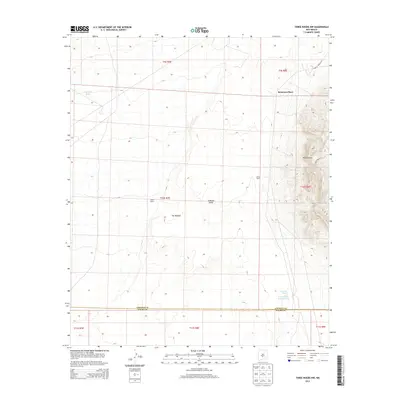
2013 Map of Three Rivers NW
USGS Topo · Published 2013About this map
Tularosa Valley dominates this high-desert landscape in southern New Mexico, where the arid plains of the basin meet the rising slopes of the Phillips Hills. The map documents a sparsely populated ranching environment defined by wide open spaces and the critical importance of water management, evidenced by isolated features like Dog Town Tank and Upper Steer Pasture Tank. These small-scale water improvements are the lifelines for the scattered homesteads and livestock operations that have long characterized this region.
Find a feature on this map
19 named features on this map. Tap any name to fly to it.
Don’t see what you’re looking for? This feature index may not catch every label — zoom into the map to look around manually.
Map Details
Editions of this 2013 Three Rivers NW Map
This is the sole edition of this map. No revisions or reprints were ever made.
Other maps of this area

1916 · Tularosa
USGS Topo · 1:125,000

1918 · Oscura Peak
USGS Topo · 1:125,000

1947 · Three Rivers
USGS Topo · 1:62,500

1947 · Capitol Peak
USGS Topo · 1:62,500

1948 · Chihuahua Ranch
USGS Topo · 1:62,500

1948 · Mockingbird Gap
USGS Topo · 1:62,500

1950 · Three Rivers
USGS Topo · 1:24,000

1950 · Oscura
USGS Topo · 1:24,000

1954 · Tularosa
USGS Topo · 1:250,000

1958 · Tularosa
USGS Topo · 1:250,000