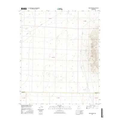
2017 Map of Three Rivers NW
USGS Topo · Published 2017About this map
The Phillips Hills dominate the eastern landscape of this high-desert region, where the terrain shifts between the mountainous ridges and the alluvial drainage of Jackson Draw. This modern 2017 survey by the U.S. Geological Survey captures the specialized infrastructure of a restricted interior, where land use is defined by government installations and ranching heritage. The presence of Dog Town Tank and Upper Steer Pasture Tank points to a history of water management in a dry environment, essential for the livestock that once moved across these townships. Tracing through the valley and over the foothills are several White Sands Missile Range access roads, including Wsmr P RT 9, Wsmr S RT 312, and Wsmr S RT 313, which provide the primary transit network through this largely uninhabited portion of the state.
Find a feature on this map
15 named features on this map. Tap any name to fly to it.
Don’t see what you’re looking for? This feature index may not catch every label — zoom into the map to look around manually.
Map Details
Editions of this 2017 Three Rivers NW Map
This is the sole edition of this map. No revisions or reprints were ever made.
Other maps of this area
1916 · Tularosa
USGS Topo · 1:125,000
1918 · Oscura Peak
USGS Topo · 1:125,000
1947 · Three Rivers
USGS Topo · 1:62,500
1947 · Capitol Peak
USGS Topo · 1:62,500
1948 · Chihuahua Ranch
USGS Topo · 1:62,500
1948 · Mockingbird Gap
USGS Topo · 1:62,500
1950 · Three Rivers
USGS Topo · 1:24,000
1950 · Oscura
USGS Topo · 1:24,000

1954 · Tularosa
USGS Topo · 1:250,000

1958 · Tularosa
USGS Topo · 1:250,000