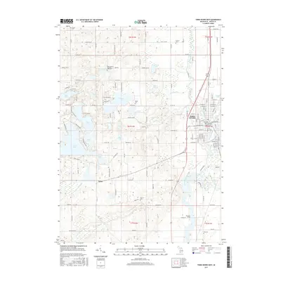
2017 Map of Three Rivers West
USGS Topo · Published 2017About this map
The confluence of the Saint Joseph River, Portage River, and Rocky River at Three Rivers serves as the focal point for this survey of Saint Joseph County. The landscape is characterized by a high density of glacial lakes, including Corey Lake, Pleasant Lake, and Long Lake, interspersed with agricultural land and rural homesteads. The small settlement of Fabius is visible along the railroad corridor, while numerous family and community burial grounds like Beadle Cem and Morrison Cem provide vital points of reference for genealogical research. Downstream on the Saint Joseph, the Florence Bridge and Memory Isle mark significant local landmarks. The intricate network of drains and creeks, such as Armalege Drain and Prairie Lake Drain, illustrates the complex hydrological management required for this water-rich region of southern Michigan.
Find a feature on this map
95 named features on this map. Tap any name to fly to it.
Don’t see what you’re looking for? This feature index may not catch every label — zoom into the map to look around manually.
Map Details
Editions of this 2017 Three Rivers West Map
This is the sole edition of this map. No revisions or reprints were ever made.
Other maps of this area

1914 · Three Rivers
USGS Topo · 1:62,500

1916 · Three Rivers
USGS Topo · 1:62,500

1922 · Schoolcraft
USGS Topo · 1:62,500

1943 · Three Rivers
USGS Topo · 1:62,500

1943 · Schoolcraft
USGS Topo · 1:62,500

1944 · Marcellus
USGS Topo · 1:62,500

1946 · Marcellus
USGS Topo · 1:62,500

1948 · Vandalia
USGS Topo · 1:62,500

1949 · Vandalia
USGS Topo · 1:62,500

1953 · Fort Wayne
USGS Topo · 1:250,000