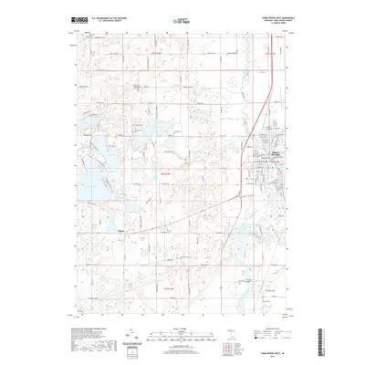
2019 Map of Three Rivers West
USGS Topo · Published 2019About this map
The confluence of the Saint Joseph River, Portage River, and Rocky River anchors the eastern edge of this landscape, where the town of Three Rivers sits at a historic intersection of water and rail. The Grand Trunk Western RR cuts across the terrain, serving an area defined by its glacial lakes and rural settlements like Fabius and Florence Bridge. Notable local landmarks include Saint Gregory's Episcopal Abbey and its associated Abbey Cem, alongside several other family and community burial grounds like Beadle Cem and Morrison Cem. A chain of water bodies, including Corey Lake, Kaiser Lake, and Clear Lake, suggests a region long shaped by its hydrography, while Memory Isle stands as a distinct topographic feature near the heart of the river system. The detailed road network, from Dutch Settlement Rd to Lovers Ln, illustrates the 21st-century evolution of these traditional Saint Joseph County townships.
Find a feature on this map
151 named features on this map. Tap any name to fly to it.
Don’t see what you’re looking for? This feature index may not catch every label — zoom into the map to look around manually.
Map Details
Editions of this 2019 Three Rivers West Map
This is the sole edition of this map. No revisions or reprints were ever made.
Other maps of this area

1914 · Three Rivers
USGS Topo · 1:62,500

1916 · Three Rivers
USGS Topo · 1:62,500

1922 · Schoolcraft
USGS Topo · 1:62,500

1943 · Three Rivers
USGS Topo · 1:62,500

1943 · Schoolcraft
USGS Topo · 1:62,500

1944 · Marcellus
USGS Topo · 1:62,500

1946 · Marcellus
USGS Topo · 1:62,500

1948 · Vandalia
USGS Topo · 1:62,500

1949 · Vandalia
USGS Topo · 1:62,500

1953 · Fort Wayne
USGS Topo · 1:250,000