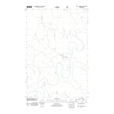
2011 Map of Three V Crossing
USGS Topo · Published 2011About this map
The Little Missouri River meanders through this western North Dakota landscape, carving a complex network of oxbows and river bends. This 2011 survey by the U.S. Geological Survey documents a region defined by ranching life and riparian geography. At the heart of the map is the eponymous Three V Crossing, a point of interest where the Vvv Rd meets the river's edge. Nearby, the Three V Ranch and the more northern Clouse Ranch signify the established presence of local landholders in this drainage basin. The hydrology of the area is further shaped by Bull Run Creek and Williams Creek, which feed into the main river channel. These watercourses dictate the local infrastructure, including the placement of unpaved routes like Johnson Rd that traverse the uplands between the creek beds.
Find a feature on this map
8 named features on this map. Tap any name to fly to it.
Don’t see what you’re looking for? This feature index may not catch every label — zoom into the map to look around manually.
Map Details
Editions of this 2011 Three V Crossing Map
This is the sole edition of this map. No revisions or reprints were ever made.
Other maps of this area

1953 · Dickinson
USGS Topo · 1:250,000

1957 · Dickinson
USGS Topo · 1:250,000

1979 · Three V Crossing
USGS Topo · 1:24,000

1980 · Golva
USGS Topo · 1:24,000

1980 · Spring Creek
USGS Topo · 1:24,000

1980 · Pretty Butte
USGS Topo · 1:24,000

1980 · Boyce Creek West
USGS Topo · 1:24,000

1980 · Alpha
USGS Topo · 1:24,000

1980 · Belfield
USGS Topo · 1:100,000

1981 · Bowman
USGS Topo · 1:100,000