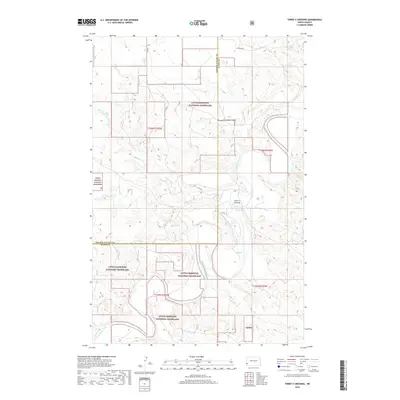
2018 Map of Three V Crossing
USGS Topo · Published 2018About this map
The Little Missouri River meanders through the heart of this landscape, carving a complex network of drainages and coulees along the border of Golden Valley and Slope Counties. This 2018 survey captures a vast section of the Little Missouri National Grassland, where the terrain is defined by the erosion of the Badlands. The namesake Three V Crossing provides a key point of reference on the river, connected by a network of ranch and forest roads like Vvv Rd and Vv Rd. Tributaries such as Bull Run Cr and Williams Cr cut through the high plateaus, illustrating the dramatic topography of western North Dakota. This modern map serves as a detailed inventory of public land management boundaries and primitive road networks in a largely uninhabited but topographically intricate region.
Find a feature on this map
14 named features on this map. Tap any name to fly to it.
Don’t see what you’re looking for? This feature index may not catch every label — zoom into the map to look around manually.
Map Details
Editions of this 2018 Three V Crossing Map
This is the sole edition of this map. No revisions or reprints were ever made.
Other maps of this area

1953 · Dickinson
USGS Topo · 1:250,000

1957 · Dickinson
USGS Topo · 1:250,000

1979 · Three V Crossing
USGS Topo · 1:24,000

1980 · Golva
USGS Topo · 1:24,000

1980 · Spring Creek
USGS Topo · 1:24,000

1980 · Pretty Butte
USGS Topo · 1:24,000

1980 · Boyce Creek West
USGS Topo · 1:24,000

1980 · Alpha
USGS Topo · 1:24,000

1980 · Belfield
USGS Topo · 1:100,000

1981 · Bowman
USGS Topo · 1:100,000