2020 Map of Three V Crossing
USGS Topo · Published 2020About this map
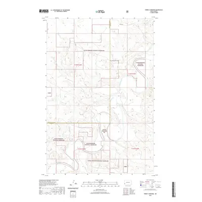
The Little Missouri National Grassland dominates this western North Dakota landscape, where the meandering Little Missouri River carves through the badlands. This modern topographical study highlights the rugged drainage basins of Williams Cr and Bull Run Cr, which feed into the river from the west. The area straddles the county line between Golden Valley and Slope counties, providing a clear view of the public land survey system grid, including townships t136n r105w and t135n r104w. Transportation is limited to a sparse network of rural routes such as Johnson Rd and VV Rd, reflecting the remote nature of these grazing lands. The map detail illustrates how the river's path dictates the topography, creating a complex series of draws and ridges within the Little Missouri NG.
Find a feature on this map
14 named features on this map. Tap any name to fly to it.
Don’t see what you’re looking for? This feature index may not catch every label — zoom into the map to look around manually.
Map Details
Editions of this 2020 Three V Crossing Map
This is the sole edition of this map. No revisions or reprints were ever made.
Other maps of this area

1953 · Dickinson
USGS Topo · 1:250,000

1957 · Dickinson
USGS Topo · 1:250,000

1979 · Three V Crossing
USGS Topo · 1:24,000

1980 · Golva
USGS Topo · 1:24,000

1980 · Spring Creek
USGS Topo · 1:24,000

1980 · Pretty Butte
USGS Topo · 1:24,000

1980 · Boyce Creek West
USGS Topo · 1:24,000

1980 · Alpha
USGS Topo · 1:24,000

1980 · Belfield
USGS Topo · 1:100,000

1981 · Bowman
USGS Topo · 1:100,000