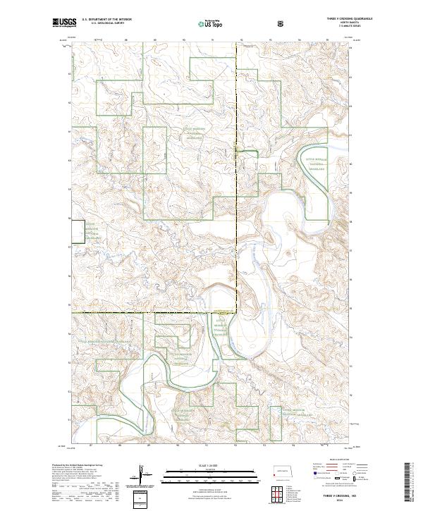
2024 Map of Three V Crossing
USGS Topo · Published 2024About this map
The Little Missouri River meanders through the heart of this landscape, carving a distinct path through the federally managed Little Missouri National Grassland. This 2024 survey documents the remote badlands region where the Golden Valley and Slope County line divides the terrain. The drainage patterns are defined by significant tributaries including Williams Creek in the northwest and Bull Run Creek further south. The map reflects a modern infrastructure of rural access roads, such as Vvv Rd and Vv Rd, which facilitate movement through the protected grasslands. The land is strictly organized by the Public Land Survey System, shown here across townships like t136n r105w and t135n r104w. This contemporary record captures the current state of conservation lands and hydrology in one of North Dakota's most iconic natural environments.
Find a feature on this map
13 named features on this map. Tap any name to fly to it.
Don’t see what you’re looking for? This feature index may not catch every label — zoom into the map to look around manually.
Map Details
Editions of this 2024 Three V Crossing Map
This is the sole edition of this map. No revisions or reprints were ever made.
Other maps of this area

1953 · Dickinson
USGS Topo · 1:250,000

1957 · Dickinson
USGS Topo · 1:250,000

1979 · Three V Crossing
USGS Topo · 1:24,000

1980 · Golva
USGS Topo · 1:24,000

1980 · Spring Creek
USGS Topo · 1:24,000

1980 · Pretty Butte
USGS Topo · 1:24,000

1980 · Boyce Creek West
USGS Topo · 1:24,000

1980 · Alpha
USGS Topo · 1:24,000

1980 · Belfield
USGS Topo · 1:100,000

1981 · Bowman
USGS Topo · 1:100,000