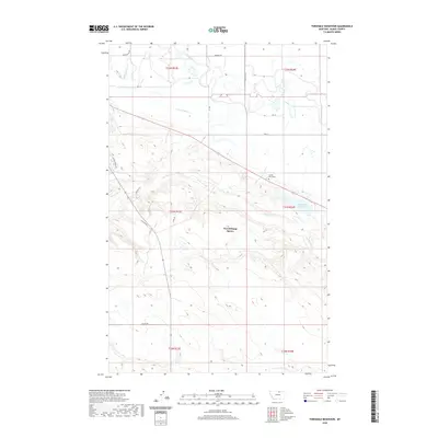
2020 Map of Threemile Reservoir
USGS Topo · Published 2020About this map
Fort Belknap Agency serves as the focal point of this northern Montana landscape, situated south of the meandering Milk River. The map reveals a highly engineered water management system essential for the region's semi-arid plains, featuring the Milk River Canal A, Main Canal A, and the N Canal that divert and distribute water across the territory. South of the river, the terrain rises toward more varied topography where Threemile Cr and Spring Cr drain toward the basin. Genealogists and local historians will find the Sacred Heart Cem positioned near the convergence of regional routes and the upper reaches of Threemile Reservoir, providing a specific point of reference for family history within the Agency District. The inclusion of named local roads like Gardipee Rd and Tincher Rd provides a clear view of the modern infrastructure and land divisions defining this part of Blaine County.
Find a feature on this map
28 named features on this map. Tap any name to fly to it.
Don’t see what you’re looking for? This feature index may not catch every label — zoom into the map to look around manually.
Map Details
Editions of this 2020 Threemile Reservoir Map
This is the sole edition of this map. No revisions or reprints were ever made.
Other maps of this area

1903 · Wayne Creek
USGS Topo · 1:62,500

1905 · Wayne Creek
USGS Topo · 1:62,500

1905 · Harlem
USGS Topo · 1:62,500

1913 · Cherry Ridge
USGS Topo · 1:125,000

1953 · Havre
USGS Topo · 1:250,000

1957 · Havre
USGS Topo · 1:250,000

1958 · Havre
USGS Topo · 1:250,000

1964 · Threemile Reservoir
USGS Topo · 1:24,000

1964 · Wayne Creek SE
USGS Topo · 1:24,000
1964 · Fort Belknap Agency
USGS Topo · 1:24,000