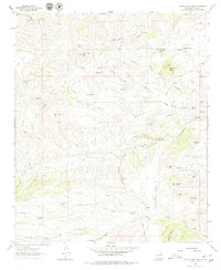
1963 Map of Thumb Tank Peak
USGS Topo · Published 1980About this map
Grandview Mesa dominates this 1963 survey of the high desert between the Black Range and the Rio Grande valley. This landscape is defined by its isolation and the critical importance of water, evidenced by the numerous improved water sources scattered across the dry canyons. Settlements are sparse, represented by ranching outposts like Evans Ranch, Avilas Camp, and Lobo Camp. The intricate network of seasonal drainages, including the North Fork Palomas Creek and the southern Salado Creek, dictates the movement of people and livestock. Topographic features such as Thumb Tank Peak and the Garcia Peaks serve as essential landmarks in an area where historical navigation relied on the Cross O Trail. The presence of named water points like Nation Well and Sophie Spring illustrates the hard-won infrastructure of mid-century Southwestern cattle ranching.
Find a feature on this map
72 named features on this map. Tap any name to fly to it.
Don’t see what you’re looking for? This feature index may not catch every label — zoom into the map to look around manually.
Map Details
Editions of this 1963 Thumb Tank Peak Map
2 editions found
Other maps of this area

1954 · Tularosa
USGS Topo · 1:250,000

1958 · Tularosa
USGS Topo · 1:250,000

1961 · Priest Tank
USGS Topo · 1:24,000

1961 · Saladone Tank
USGS Topo · 1:24,000

1961 · Williamsburg NW
USGS Topo · 1:24,000

1963 · Bell Mountain
USGS Topo · 1:24,000

1963 · Thumb Tank Peak
USGS Topo · 1:24,000

1963 · Sugarloaf Peak
USGS Topo · 1:24,000

1963 · Apache Peak
USGS Topo · 1:24,000

1965 · Winston
USGS Topo · 1:24,000