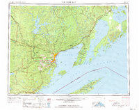
1959 Map of Thunder Bay
USGS Topo · Published 1973About this map
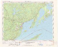
Thunder Bay serves as the focal point for this mid-century international border study, anchoring a region defined by the combined port industrial power of Port Arthur and Fort William. The map illustrates a landscape of transit and heavy industry where the Canadian Pacific and Canadian National railroads converge at the lakehead. Beyond the urban centers, the geography is punctuated by significant natural features like the Sibley Peninsula and the distinctive silhouette of The Sleeping Giant. This era shows the developed corridor of the Trans-Canada Highway running north of the bay, while more isolated settlements like Silver Islet and South Gillies speak to the region's mining and pioneer history. South across the international boundary, the wilderness of Isle Royale National Park sits in the open waters of Lake Superior, providing a sharp contrast to the dense rail and road networks of the mainland.
Find a feature on this map
194 named features on this map. Tap any name to fly to it.
Don’t see what you’re looking for? This feature index may not catch every label — zoom into the map to look around manually.
Map Details
Editions of this 1959 Thunder Bay Map
3 editions found

Other maps of this area

1895 · Passage Island
USGS Topo · 1:62,500

1954 · Two Harbors
USGS Topo · 1:250,000

1957 · Two Harbors
USGS Topo · 1:250,000

1957 · Quetico
USGS Topo · 1:250,000

1958 · Two Harbors
USGS Topo · 1:250,000

1958 · Hancock
USGS Topo · 1:250,000
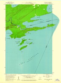
1959 · Pigeon Point
USGS Topo · 1:24,000

1959 · Mineral Center
USGS Topo · 1:24,000

1959 · Pine Lake East
USGS Topo · 1:24,000

1959 · Tom Lake
USGS Topo · 1:24,000