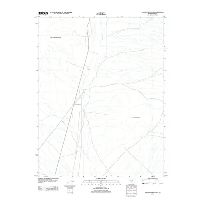
2012 Map of Thunder Mountain
USGS Topo · Published 2012About this map
The eastern foothills of the San Antonio Mountains meet the high desert floor in this Nye County landscape. At the center of the sheet, the small settlement of Rye Patch sits along the primary north-south thoroughfare, which is joined by local routes including Prison Rd and Sportsman Park Rd. The terrain is defined by the alluvial fans of the Great Basin, where seasonal drainages like Hunts Creek flow eastward from the mountains toward the alkali flats. To the southeast, the namesake Thunder Mountain rises as a prominent landmark. This 2012 survey documents the modern road network and sparse human footprint in an area characterized by its arid geography and mountain vistas.
Find a feature on this map
6 named features on this map. Tap any name to fly to it.
Don’t see what you’re looking for? This feature index may not catch every label — zoom into the map to look around manually.
Map Details
Editions of this 2012 Thunder Mountain Map
This is the sole edition of this map. No revisions or reprints were ever made.
Other maps of this area

1907 · Tonopah
USGS Topo · 1:250,000

1908 · Tonopah
USGS Topo · 1:250,000

1956 · Tonopah
USGS Topo · 1:250,000

1959 · Tonopah
USGS Topo · 1:250,000
1960 · Tonopah
USGS Topo · 1:24,000

1961 · Tonopah
USGS Topo · 1:62,500

1962 · Tonopah
USGS Topo · 1:250,000

1963 · Baxter Spring
USGS Topo · 1:62,500

1971 · Antelope Spring
USGS Topo · 1:24,000
1986 · Hannapah
USGS Topo · 1:24,000