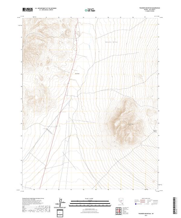
2021 Map of Thunder Mountain
USGS Topo · Published 2021About this map
Thunder Mtn rises as a prominent landmark over the eastern portion of this Nye County landscape, dominating the transition from high valley to arid basin. The area is defined by the broad Ralston Valley, where the drainage of Hunts Cr makes its way south. To the west, the tiny settlement of Rye Patch sits along the roadway, marking a rare point of named human habitation in an otherwise expansive and open terrain. The eastern edge of the quadrangle gives way to the Ralston Desert, while Conservation Camp Rd cuts through the southwest, suggesting the specialized infrastructure that supports management of this remote section of Nevada. This map provides a clear record of the relationship between sparse water sources and the road networks that connect isolated outposts in the Great Basin.
Find a feature on this map
12 named features on this map. Tap any name to fly to it.
Don’t see what you’re looking for? This feature index may not catch every label — zoom into the map to look around manually.
Map Details
Editions of this 2021 Thunder Mountain Map
This is the sole edition of this map. No revisions or reprints were ever made.
Other maps of this area

1907 · Tonopah
USGS Topo · 1:250,000

1908 · Tonopah
USGS Topo · 1:250,000

1956 · Tonopah
USGS Topo · 1:250,000

1959 · Tonopah
USGS Topo · 1:250,000
1960 · Tonopah
USGS Topo · 1:24,000

1961 · Tonopah
USGS Topo · 1:62,500

1962 · Tonopah
USGS Topo · 1:250,000

1963 · Baxter Spring
USGS Topo · 1:62,500

1971 · Antelope Spring
USGS Topo · 1:24,000
1986 · Hannapah
USGS Topo · 1:24,000