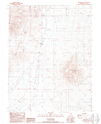
1987 Map of Thunder Mtn
USGS Topo · Published 1987About this map
Thunder Mountain rises as the dominant topographic landmark in this 1987 survey of central Nevada, overlooking the broad expanse of the Ralston Valley. The landscape is defined by resource extraction and water infrastructure, anchored by the Midway Mine and several industrial Gravel Pits and Borrow Pits scattered near the foothills of the San Antonio Mountains. The technical development of the region is evident through the presence of a Transmission Line and a prominent Aqueduct traversing the valley floor. Water management is a critical theme of this desert environment, marked by the Rye Patch Pumping Station, various Wells, and storage Tanks. This map captures the industrial character of Nye County during the late 20th century, where the rugged terrain meets the specialized infrastructure required for high-desert mining and utility operations.
Find a feature on this map
14 named features on this map. Tap any name to fly to it.
Don’t see what you’re looking for? This feature index may not catch every label — zoom into the map to look around manually.
Map Details
Editions of this 1987 Thunder Mtn Map
This is the sole edition of this map. No revisions or reprints were ever made.
Other maps of this area

1907 · Tonopah
USGS Topo · 1:250,000

1908 · Tonopah
USGS Topo · 1:250,000

1956 · Tonopah
USGS Topo · 1:250,000

1959 · Tonopah
USGS Topo · 1:250,000
1960 · Tonopah
USGS Topo · 1:24,000

1961 · Tonopah
USGS Topo · 1:62,500

1962 · Tonopah
USGS Topo · 1:250,000

1963 · Baxter Spring
USGS Topo · 1:62,500

1971 · Antelope Spring
USGS Topo · 1:24,000
1986 · Hannapah
USGS Topo · 1:24,000