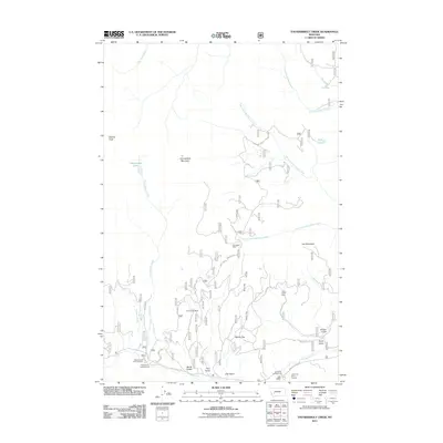
2011 Map of Thunderbolt Creek
USGS Topo · Published 2011About this map
The high peaks of Electric Peak and Thunderbolt Mountain anchor this interior Montana landscape, where the headwaters of Thunderbolt Creek and the Boulder River have carved a complex system of gulches. This 2011 survey documents a legacy of mountain extraction, evidenced by the Saratoga Mine, Boyle Gulch Mine, and Torpy Gulch Mine scattered across the drainage basins. These mining sites are connected by a network of forest roads like the Red Rock Connection and Management Rd, which navigate the steep elevations between Iron Mountain and the broad opening of Berkin Flat. The area serves as a modern recreational hub, featuring sites such as the Whitehouse Campground and Ladysmith Picnic Ground. The presence of numerous named gulches—including Finn Gulch, Alta Gulch, and Olinger Gulch—points to a localized history of prospecting and drainage-based land claims that once defined this portion of Jefferson County.
Find a feature on this map
33 named features on this map. Tap any name to fly to it.
Don’t see what you’re looking for? This feature index may not catch every label — zoom into the map to look around manually.
Map Details
Editions of this 2011 Thunderbolt Creek Map
This is the sole edition of this map. No revisions or reprints were ever made.
Other maps of this area

1889 · Helena
USGS Topo · 1:250,000

1893 · Helena
USGS Topo · 1:250,000

1899 · Boulder
USGS Topo · 1:125,000

1899 · Helena
USGS Topo · 1:250,000

1903 · Helena
USGS Topo · 1:250,000

1947 · Butte
USGS Topo · 1:250,000

1954 · Elk Park
USGS Topo · 1:62,500

1954 · Basin
USGS Topo · 1:62,500

1958 · Butte
USGS Topo · 1:250,000

1959 · Butte North
USGS Topo · 1:62,500