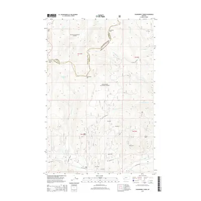
2014 Map of Thunderbolt Creek
USGS Topo · Published 2014About this map
The Continental Divide winds through the high country of Jefferson and Powell Counties, marking a significant hydrologic boundary within the Helena National Forest and Deerlodge National Forest. This section of the Rockies is defined by prominent summits such as Electric Peak and Thunderbolt Mtn, which overlook a network of drainages feeding the Boulder River. The landscape is etched with numerous named gulches and flats, including Finn Gulch, Alta Gulch, and Berkin Flat, suggesting a history of land use and navigation in these steep drainages. High-altitude water bodies like Cottonwood Lake and Cliff Lake occupy basins between the peaks. A system of forest roads, notably the Red Rock Connection and Thunderbolt Creek Rd, provides access across the rugged terrain, following the natural contours of the mountains and the path of Thunderbolt Creek toward the valley floor.
Find a feature on this map
36 named features on this map. Tap any name to fly to it.
Don’t see what you’re looking for? This feature index may not catch every label — zoom into the map to look around manually.
Map Details
Editions of this 2014 Thunderbolt Creek Map
This is the sole edition of this map. No revisions or reprints were ever made.
Other maps of this area

1889 · Helena
USGS Topo · 1:250,000

1893 · Helena
USGS Topo · 1:250,000

1899 · Boulder
USGS Topo · 1:125,000

1899 · Helena
USGS Topo · 1:250,000

1903 · Helena
USGS Topo · 1:250,000

1947 · Butte
USGS Topo · 1:250,000

1954 · Elk Park
USGS Topo · 1:62,500

1954 · Basin
USGS Topo · 1:62,500

1958 · Butte
USGS Topo · 1:250,000

1959 · Butte North
USGS Topo · 1:62,500