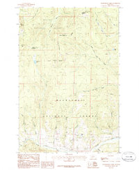
1985 Map of Thunderbolt Creek
USGS Topo · Published 1986About this map
The Continental Divide winds through this high-altitude landscape of the early 1980s, marking the hydrological boundary between the Helena National Forest and Deerlodge National Forest. This montane region is defined by its series of towering summits, including Electric Peak, Thunderbolt Mountain, and Cliff Mountain, which overlook a network of deep drainages. Mining activity is evident through numerous identified prospects concentrated near Finn Gulch, Alta Gulch, and the Boulder River, hinting at the geological explorations that have long characterized the Powell and Jefferson County border.
Find a feature on this map
35 named features on this map. Tap any name to fly to it.
Don’t see what you’re looking for? This feature index may not catch every label — zoom into the map to look around manually.
Map Details
Editions of this 1985 Thunderbolt Creek Map
This is the sole edition of this map. No revisions or reprints were ever made.
Other maps of this area

1889 · Helena
USGS Topo · 1:250,000

1893 · Helena
USGS Topo · 1:250,000

1899 · Boulder
USGS Topo · 1:125,000

1899 · Helena
USGS Topo · 1:250,000

1903 · Helena
USGS Topo · 1:250,000

1947 · Butte
USGS Topo · 1:250,000

1954 · Elk Park
USGS Topo · 1:62,500

1954 · Basin
USGS Topo · 1:62,500

1958 · Butte
USGS Topo · 1:250,000

1959 · Butte North
USGS Topo · 1:62,500