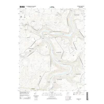
2014 Map of Thurmond
USGS Topo · Published 2014About this map
New River Gorge National River dominates this landscape, carving a deep corridor through the mountains where the New River meets its tributaries like Dunloup Cr and Arbuckle Cr. At the center of the gorge sits Thurmond, a storied rail hub accessible by the Thurmond Bridge. The map traces the winding Thurmond-McEndree Rd as it connects several riverside settlements that were once vital to the region's industrial pulse, including McKendree, Claremont, and Thayer. Along the higher elevations and ridges, the terrain transitions toward Oak Hill and the community of Minden. The topography reveals the logistical challenges of this era, with many locales like Sewell and Beury positioned deep within the canyon, while Gethsemane Memorial Gardens and Pea Ridge occupy the more stable ground above the river's dramatic descent through Surprise Rapids and Silo Rapids.
Find a feature on this map
83 named features on this map. Tap any name to fly to it.
Don’t see what you’re looking for? This feature index may not catch every label — zoom into the map to look around manually.
Map Details
Editions of this 2014 Thurmond Map
This is the sole edition of this map. No revisions or reprints were ever made.
Other maps of this area

1887 · Hinton
USGS Topo · 1:125,000

1889 · Nicholas
USGS Topo · 1:125,000

1891 · Nicholas
USGS Topo · 1:125,000

1891 · Raleigh
USGS Topo · 1:125,000

1892 · Hinton
USGS Topo · 1:125,000

1897 · Kanawha Falls
USGS Topo · 1:125,000

1897 · Raleigh
USGS Topo · 1:125,000

1900 · Kanawha Falls
USGS Topo · 1:125,000

1901 · Nicholas
USGS Topo · 1:125,000

1901 · Kanawha Falls
USGS Topo · 1:125,000