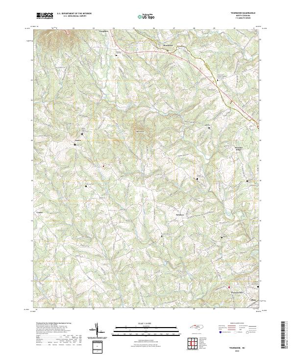
2022 Map of Thurmond
USGS Topo · Published 2022About this map
Thurmond and the surrounding foothills of the Blue Ridge define this landscape along the border of Surry and Wilkes Counties. The map reveals a dense network of small communities and rural family churchyards, including State Road Primitive Baptist Church Cem and Mining Ridge Cem. The terrain is deeply incised by watercourses like the S Fork Mitchell River and Elkin Cr, which create the dramatic drop at Carter Falls near the southern edge.
Find a feature on this map
156 named features on this map. Tap any name to fly to it.
Don’t see what you’re looking for? This feature index may not catch every label — zoom into the map to look around manually.
Map Details
Editions of this 2022 Thurmond Map
This is the sole edition of this map. No revisions or reprints were ever made.
Other maps of this area

1889 · Wilkesboro
USGS Topo · 1:125,000

1891 · Wilkesboro
USGS Topo · 1:125,000

1891 · Yadkinville
USGS Topo · 1:125,000

1893 · Yadkinville
USGS Topo · 1:125,000

1953 · Winston-Salem
USGS Topo · 1:250,000

1955 · Winston-Salem
USGS Topo · 1:250,000

1962 · Winston-Salem
USGS Topo · 1:250,000

1966 · Roaring River
USGS Topo · 1:24,000
1968 · Glade Valley
USGS Topo · 1:24,000
1968 · Traphill
USGS Topo · 1:24,000