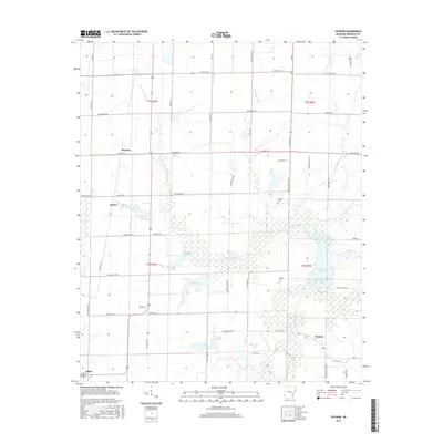
2017 Map of Tichnor
USGS Topo · Published 2017About this map
Point Deluce Bayou meanders through the wetlands of southern Arkansas County, defining a landscape dominated by intricate water systems and rural land divisions. This 2017 survey shows the agricultural character of the region, where numerous named lakes such as Lowe Lake, Gregory Lake, and Lake Wisdom dot the terrain alongside more formal structures like the Childers Lake Dam. The map provides specific detail for genealogists and local historians, capturing the small communities of Tichnor, Hyden, and Mayview, as well as the northern outskirts of Gillett. Family-named landmarks and historical sites are preserved here, including the Childers Cem and Conine Cem. The road network, featuring routes like State Hwy 152 and State Hwy 44, connects these remote settlements and bypasses major reservoirs like the Ward Reservoir, illustrating the enduring relationship between the local economy and the bayou's hydrology.
Find a feature on this map
66 named features on this map. Tap any name to fly to it.
Don’t see what you’re looking for? This feature index may not catch every label — zoom into the map to look around manually.
Map Details
Editions of this 2017 Tichnor Map
This is the sole edition of this map. No revisions or reprints were ever made.
Other maps of this area

1935 · Gillett
USGS Topo · 1:62,500

1939 · Indian Bay
USGS Topo · 1:62,500

1939 · Henrico
USGS Topo · 1:62,500

1941 · De Witt
USGS Topo · 1:62,500

1948 · Helena
USGS Topo · 1:250,000

1950 · Helena
USGS Topo · 1:250,000

1954 · Indian Bay
USGS Topo · 1:62,500

1954 · De Witt
USGS Topo · 1:62,500

1954 · Henrico
USGS Topo · 1:62,500

1955 · Helena
USGS Topo · 1:250,000