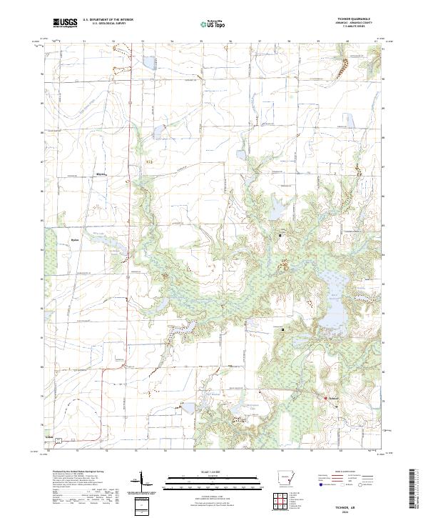
2024 Map of Tichnor
USGS Topo · Published 2024About this map
Point Deluce Bayou meanders through the heart of this Arkansas County landscape, feeding a network of local waters including Greggory Lake, Botts Lake, and Tupelo Hole. The area is characterized by the expansive Dale Bumpers White River NWR, which covers much of the southeastern portion of the quadrangle. Small settlements like Tichnor and Mayview anchor the rural road system, while localized history is preserved at the Childers Cem and Conine Cem. The terrain is shaped by both natural drainage and human management, evidenced by the Hesser Levee Rd and various reservoirs such as Ward Reservoir. This map documents a region defined by its bottomland hydrology and agricultural infrastructure, where the confluence of bayous and lakes dictates the placement of roads like State Hwy 44 and State Hwy 152.
Find a feature on this map
67 named features on this map. Tap any name to fly to it.
Don’t see what you’re looking for? This feature index may not catch every label — zoom into the map to look around manually.
Map Details
Editions of this 2024 Tichnor Map
This is the sole edition of this map. No revisions or reprints were ever made.
Other maps of this area

1935 · Gillett
USGS Topo · 1:62,500

1939 · Indian Bay
USGS Topo · 1:62,500

1939 · Henrico
USGS Topo · 1:62,500

1941 · De Witt
USGS Topo · 1:62,500

1948 · Helena
USGS Topo · 1:250,000

1950 · Helena
USGS Topo · 1:250,000

1954 · Indian Bay
USGS Topo · 1:62,500

1954 · De Witt
USGS Topo · 1:62,500

1954 · Henrico
USGS Topo · 1:62,500

1955 · Helena
USGS Topo · 1:250,000