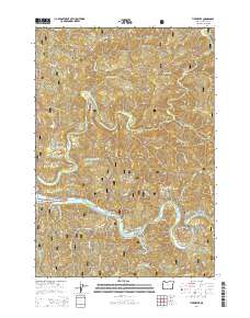
2014 Map of Tidewater
USGS Topo · Published 2014About this map
The Alsea River winds through the heart of this coastal valley, where small riverside communities like Alsea Riviera and Little Albany define the local settlement pattern. This 2014 survey documents the unique residential clusters along the river's path, including Westwood Village and Little Switzerland, situated south of the Siuslaw National Forest boundary. The landscape is characterized by steep, timbered ridges such as Boulder Ridge and Butler Ridge, rising above a dense network of drainages including Drift Creek and Canal Cr. For genealogists and local historians, the presence of the Tidewater Cem near the settlement of Tidewater provides a specific point of interest in this part of Lincoln County. The map also traces vital local infrastructure, from the Alsea Hwy following the riverbanks to forest access roads like Nat For Dev Rd 3484 that penetrate the high terrain around Butler Peak.
Find a feature on this map
83 named features on this map. Tap any name to fly to it.
Don’t see what you’re looking for? This feature index may not catch every label — zoom into the map to look around manually.
Map Details
Editions of this 2014 Tidewater Map
This is the sole edition of this map. No revisions or reprints were ever made.
Other maps of this area

1922 · Waldport
USGS Topo · 1:62,500

1942 · Waldport
USGS Topo · 1:62,500

1942 · Yaquina
USGS Topo · 1:62,500

1942 · Tidewater
USGS Topo · 1:62,500

1942 · Toledo
USGS Topo · 1:62,500

1953 · Salem
USGS Topo · 1:250,000

1954 · Salem
USGS Topo · 1:250,000

1956 · Tidewater
USGS Topo · 1:62,500

1956 · Waldport
USGS Topo · 1:62,500

1957 · Yaquina
USGS Topo · 1:62,500