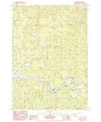
1984 Map of Tidewater
USGS Topo · Published 1984About this map
The Alsea River carves a deep, winding path through the Siuslaw National Forest in this mid-1980s coastal range survey. The landscape is defined by the tight meanders of the river and a series of small, riverside communities including Tidewater, Little Albany, and Westwood Village. The proximity of these settlements to the water, often connected by features like a Boat Ramp or a Foot Bridge, underscores a local economy and lifestyle traditionally tied to the river's flow and the surrounding timberlands.
Find a feature on this map
44 named features on this map. Tap any name to fly to it.
Don’t see what you’re looking for? This feature index may not catch every label — zoom into the map to look around manually.
Map Details
Editions of this 1984 Tidewater Map
This is the sole edition of this map. No revisions or reprints were ever made.
Other maps of this area

1922 · Waldport
USGS Topo · 1:62,500

1942 · Waldport
USGS Topo · 1:62,500

1942 · Yaquina
USGS Topo · 1:62,500

1942 · Tidewater
USGS Topo · 1:62,500

1942 · Toledo
USGS Topo · 1:62,500

1953 · Salem
USGS Topo · 1:250,000

1954 · Salem
USGS Topo · 1:250,000

1956 · Tidewater
USGS Topo · 1:62,500

1956 · Waldport
USGS Topo · 1:62,500

1957 · Yaquina
USGS Topo · 1:62,500