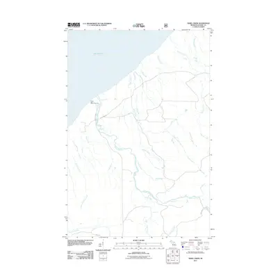
2011 Map of Tiebel Creek
USGS Topo · Published 2011About this map
Lake Superior dominates the northern horizon of this landscape, where the Presque Isle River carves a dramatic path toward the coast. The river is punctuated by a series of significant drops, including Manabezho Falls, Manido Falls, and Nawadaha Falls near the Presque Isle State Campground. This coastal area in the western Upper Peninsula is defined by its numerous named waterfalls on tributary streams, such as Pinkerton Falls on Pinkerton Creek and a cluster of falls on Copper Creek including Abinodji Falls and Ogima Falls. The drainage network is complex, with Tiebel Creek and Speaker Creek flowing through the central timberlands. Access to these remote waterways is provided by a few established routes like Presque Isle Rd and S Boundary Rd, tracing the transition from the interior highlands to the great lake shore.
Find a feature on this map
34 named features on this map. Tap any name to fly to it.
Don’t see what you’re looking for? This feature index may not catch every label — zoom into the map to look around manually.
Map Details
Editions of this 2011 Tiebel Creek Map
This is the sole edition of this map. No revisions or reprints were ever made.
Other maps of this area

1953 · Ashland
USGS Topo · 1:250,000

1956 · Carp River
USGS Topo · 1:62,500

1956 · North Ironwood
USGS Topo · 1:62,500

1956 · Thomaston
USGS Topo · 1:62,500

1958 · Ashland
USGS Topo · 1:250,000

1958 · Iron River
USGS Topo · 1:250,000

1960 · Iron River
USGS Topo · 1:250,000

1961 · Iron River
USGS Topo · 1:250,000

1967 · Iron River
USGS Topo · 1:250,000

1979 · Ontonagon
USGS Topo · 1:100,000