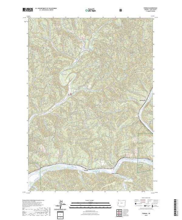
2024 Map of Tiernan
USGS Topo · Published 2024About this map
The Siuslaw River corridor and its tidal influence dominate this portion of Lane County, where the southern valley contains the small riverside settlements of Tiernan and Point Terrace. This modern survey illustrates the complex drainage system of the Siuslaw National Forest, where steep coastal ridges like Misery Ridge and Hanson Ridge overlook a network of tributary creeks. The presence of Duncan Inlet and Sweet Creek near the main river channel indicates the transition from upland forestry to the estuarine environment of the Oregon coast.
Find a feature on this map
51 named features on this map. Tap any name to fly to it.
Don’t see what you’re looking for? This feature index may not catch every label — zoom into the map to look around manually.
Map Details
Editions of this 2024 Tiernan Map
This is the sole edition of this map. No revisions or reprints were ever made.
Other maps of this area

1918 · Mapleton
USGS Topo · 1:48,000

1919 · Earl
USGS Topo · 1:48,000

1920 · Siltcoos Lake
USGS Topo · 1:62,500

1920 · Heceta Head
USGS Topo · 1:62,500

1940 · Mapleton
USGS Topo · 1:62,500

1941 · Siltcoos Lake
USGS Topo · 1:62,500

1942 · Heceta Head
USGS Topo · 1:62,500

1942 · Siltcoos Lake
USGS Topo · 1:62,500

1943 · Goodwin Peak
USGS Topo · 1:62,500

1945 · Mapleton
USGS Topo · 1:62,500