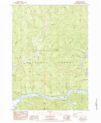
1984 Map of Tiernan
USGS Topo · Published 1984About this map
Siuslaw River and its numerous tributaries dominate this coastal Oregon landscape, where the waterway carves through the timberlands of the Siuslaw National Forest. Small riverfront settlements and railroad stops like Tiernan, Beck Station, and Point Terrace cling to the southern bank, following the path of the Southern Pacific line as it skirts the river's edge. The complex drainage network is evidenced by dozens of named creeks, including Cataract Creek, Sweet Creek, and Shoemaker Creek, which descend from high points like Neely Mountain and Walker.
Find a feature on this map
54 named features on this map. Tap any name to fly to it.
Don’t see what you’re looking for? This feature index may not catch every label — zoom into the map to look around manually.
Map Details
Editions of this 1984 Tiernan Map
This is the sole edition of this map. No revisions or reprints were ever made.
Other maps of this area

1918 · Mapleton
USGS Topo · 1:48,000

1919 · Earl
USGS Topo · 1:48,000

1920 · Siltcoos Lake
USGS Topo · 1:62,500

1920 · Heceta Head
USGS Topo · 1:62,500

1940 · Mapleton
USGS Topo · 1:62,500

1941 · Siltcoos Lake
USGS Topo · 1:62,500

1942 · Heceta Head
USGS Topo · 1:62,500

1942 · Siltcoos Lake
USGS Topo · 1:62,500

1943 · Goodwin Peak
USGS Topo · 1:62,500

1945 · Mapleton
USGS Topo · 1:62,500