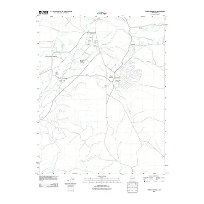
2011 Map of Tierra Amarilla
USGS Topo · Published 2011About this map
Tierra Amarilla serves as the focal point of this northern New Mexico landscape, situated at the junction where the Rito de Tierra Amarilla meets a complex network of traditional irrigation infrastructure. The map reveals the critical role of water management in the region, featuring an extensive system of man-made waterways including the Tierra Amarilla Ditch, El Porvenir Community Ditch, and the Willow Creek Mesa Ditch. These ditches underscore the historical acequia systems that have long supported agricultural life near settlements like Ensenada and La Puente. Significant cultural preservation is evident through the identification of three distinct historic areas: the Tierra Amarilla Historic District, Los Ojos Historic District, and La Puente Historic District. Beyond the residential centers, the environment is defined by the Rio Brazos and Rio Chama, while the Los Ojos Fish Hatchery and Eturriaga Rock Quarry point to the local intersection of natural resources and regional industry.
Find a feature on this map
46 named features on this map. Tap any name to fly to it.
Don’t see what you’re looking for? This feature index may not catch every label — zoom into the map to look around manually.
Map Details
Editions of this 2011 Tierra Amarilla Map
This is the sole edition of this map. No revisions or reprints were ever made.
Other maps of this area

1918 · Tusas
USGS Topo · 1:125,000

1954 · Aztec
USGS Topo · 1:250,000

1955 · Chama
USGS Topo · 1:62,500

1955 · Cebolla
USGS Topo · 1:62,500

1955 · Brazos Peak
USGS Topo · 1:62,500

1955 · Tierra Amarilla
USGS Topo · 1:62,500

1958 · Aztec
USGS Topo · 1:250,000

1962 · Aztec
USGS Topo · 1:250,000

1965 · Aztec
USGS Topo · 1:250,000

1981 · Chama
USGS Topo · 1:100,000