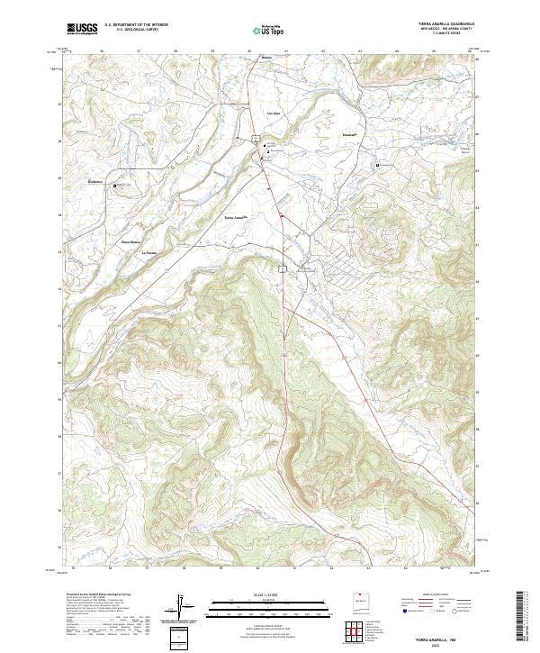
2023 Map of Tierra Amarilla
USGS Topo · Published 2023About this map
The Rio Arriba County Courthouse stands as the civic heart of this northern New Mexico landscape, surrounded by a complex network of traditional acequias. These irrigation channels, including the Tierra Amarilla Community Ditch, El Porvenir Community Ditch, and Ensenada Ditch, trace the historical agricultural patterns along the Rio Chama and Rio Brazos. The map documents numerous early Hispanic settlements such as Los Ojos, Brazos, Ensenada, and La Puente, each deeply tied to the valley's water management system.
Find a feature on this map
45 named features on this map. Tap any name to fly to it.
Don’t see what you’re looking for? This feature index may not catch every label — zoom into the map to look around manually.
Map Details
Editions of this 2023 Tierra Amarilla Map
This is the sole edition of this map. No revisions or reprints were ever made.
Other maps of this area

1918 · Tusas
USGS Topo · 1:125,000

1954 · Aztec
USGS Topo · 1:250,000

1955 · Chama
USGS Topo · 1:62,500

1955 · Cebolla
USGS Topo · 1:62,500

1955 · Brazos Peak
USGS Topo · 1:62,500

1955 · Tierra Amarilla
USGS Topo · 1:62,500

1958 · Aztec
USGS Topo · 1:250,000

1962 · Aztec
USGS Topo · 1:250,000

1965 · Aztec
USGS Topo · 1:250,000

1981 · Chama
USGS Topo · 1:100,000