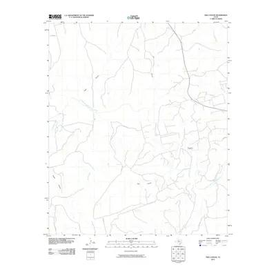
2010 Map of Tige Canyon
USGS Topo · Published 2010About this map
The Double Mountain Fork Brazos River carves a winding path across this West Texas landscape, defining the local drainage system that feeds into the Rough Draw Oil Field. The terrain is deeply dissected by a network of erosional features, including the eponymous Tige Canyon and several others named for local families or landmarks, such as Adair Canyon, Ivy Canyon, and Poteet Canyon.
Find a feature on this map
15 named features on this map. Tap any name to fly to it.
Don’t see what you’re looking for? This feature index may not catch every label — zoom into the map to look around manually.
Map Details
Editions of this 2010 Tige Canyon Map
This is the sole edition of this map. No revisions or reprints were ever made.
Other maps of this area

1893 · Roby
USGS Topo · 1:125,000

1926 · Snyder 1-a
USGS Topo · 1:48,000

1926 · Roby 2-b
USGS Topo · 1:48,000

1931 · Rotan
USGS Topo · 1:62,500

1932 · Camp Springs
USGS Topo · 1:62,500

1954 · Lubbock
USGS Topo · 1:250,000

1954 · Big Spring
USGS Topo · 1:250,000

1958 · Big Spring
USGS Topo · 1:250,000

1968 · Double Mountains
USGS Topo · 1:24,000
1969 · White Canyon
USGS Topo · 1:24,000